
View a map of the flood protection zones (PDF)
Zone Development and Funding
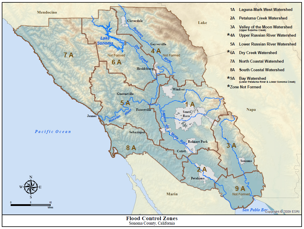
In 1958, under the authority of Sonoma Water's enabling legislation, the formation of nine geographical zones, each encompassing a major watershed, was proposed as a means of financing the construction and maintenance of flood protection works within Sonoma County.
Over the succeeding several years, Zones 1A, 2A, 3A, 5A, 7A and 8A were officially formed. Zones 1A, 2A, and 3A have Zone Advisory Committees that annually prioritize and approve capital improvement projects for their respective zones.
In November 1986 and again in 1996, landowners in Zones 1A and 2A authorized the levying of benefit assessments within these two zones for 10 years to augment the limited funds received from general property taxes. These assessments expired in 2006..
The officially formed zones have financed the construction of flood protection and drainage facilities, the maintenance of natural waterways, the preparation of master drainage plans for areas subject to flooding, and erosion and sediment control activities. The zones have also financed the flood protection operation and maintenance activities of Sonoma Water.
Learn more about the Flood Protection Zone Advisory Committees
See maps for each of the nine zones below:
- Zone 1A - Laguna de Santa Rosa - Mark West Creek watershed
- Zone 2A - Petaluma River watershed
- Zone 3A - Valley of the Moon watershed (Upper Sonoma Creek)
- Zone 4A - Upper Russian River watershed - ZONE NOT FORMED
- Zone 5A - Lower Russian River watershed (the Russian River from the mouth to Redwood Highway Bridge at Healdsburg, excluding Zone 1A)
- Zone 6A - Dry Creek watershed - ZONE NOT FORMED
- Zone 7A North Coastal watershed
- Zone 8A - South Coastal watershed
- Zone 9A Bay watershed (Lower Petaluma River and Lower Sonoma Creek) - ZONE NOT FORMED